06
Jul, 2018

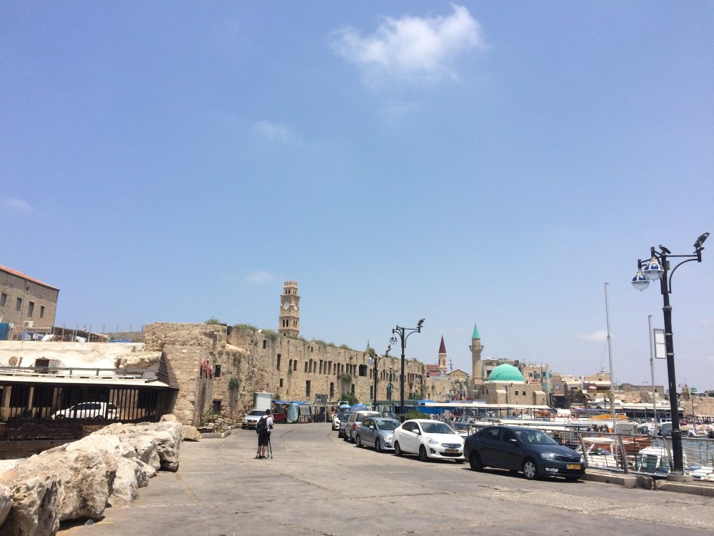
When you ride Soarin’ in Walt Disney World’s Epcot, puffs of scent come out during the different scenes: jasmine above the Taj Mahal, plumeria over Hawaii, or my favorite grass smell beneath Mount Kilimanjaro. Of course, if you look to your left or right, you remember you are, in fact, just on a ride. But one thing that Disney got right is that smells are a crucial part of experiencing locations. I won’t be able to take it with me, but the smells of the Old City of Akko will always be in the back of my mind when I remember these streets.[/vc_column_text][/vc_column][/vc_row]
The air is thick. The sun has yet to rise. A peacock calls in the distance. You can barely see the tell. We wait in the dark for dawn to break and then we take off…
This sounds like the beginning of an epic adventure through the wild unknown. It’s not. This is not a tale of some crazy Tomb Raider/Librarian/Indiana Jones. This story won’t involve the adrenaline rush of running from a boulder, but in a way, it has its own beauty and excitement to it. Every morning, I get a slight rush of adrenaline when I nearly fall off the tell to get the perfect shot, all to create a virtual 3D model of what we dig every day.
Worth it?
…Yes.
Why?
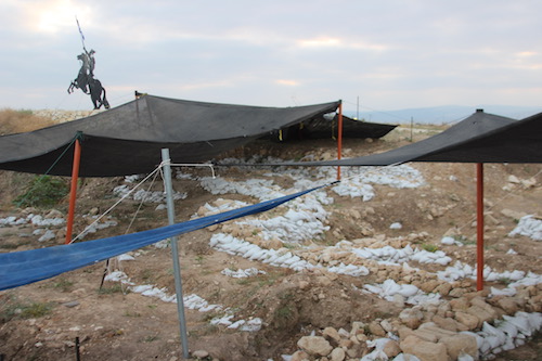
Because this is a really interesting, fairly new technique that has amazing potential for the future of archaeology. At present, many sites use 3D models to record excavation units. It can be used to model most everything from a small vessel to a full site like Akko. On this excavation, this technique is most often used to model the five by five meter squares we excavate every day. Every morning, a few individuals ride out to the tell before sunrise and the rest of the team to photograph the active squares of the excavation. And then we wait. We wait for dawn. We wait for the sun to rise just enough where it is not shinning yet, but it is light enough that the camera can detect features and colors of the site. And then we go into the field and start the process of making a 3D model.
To create a model, we first collect the data (take the photos). We essentially walk around the square 360 degrees, taking photos at eyelevel every couple of steps. Then we round the square again, this time taking a series of overhead shots. The reason for this is to get as full a picture as possible so that when we feed the 40 or 50 photos into a program, it can produce a detailed 3-dimensional model of the square. In short, we are looking at an object in reality, capturing it in a 2D digital image, and then reproducing that image as a 3D model in virtual space.
Being able to create virtual 3-dimesional models is cool enough, but what is really interesting about this process is that there are so many things that can be done with this model. On this project, the 3D models are usually used to create the blueprint from which we draw our plans, write our notes, and record what happens in the square. But there is the potential to do so much more with these models! Because we photograph all of the active squares every day, we can layer these models over one another and create a sort of time lapse of the square. Essentially we are able to track the changes and advance of the excavation over the entire season, seeing the first day and the last day of excavation in one 3-dimensional digital space, long after the soil in the physical space has been carried and sifted away. Looking forward in archaeology, this is a major advance in record keeping that the current generation of archaeologists could have benefited from if their predecessors had had the technology (especially on this dig).
Some sites are even going one step further, using these 3D models to create a virtual reality. Using gaming software and very talented artists, archaeologist can create what is termed a 4D space. They use the 3D model as a base to then recreate what they think the site would have looked like at a given time period. This has a lot of potential for promoting public outreach and understanding. By creating a visual world, the public can understand what we are excavating and bring our world of rubble and dirt closer to the reality it once was.
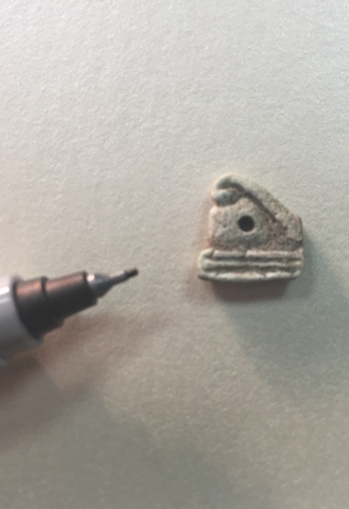
A tiny find representing the Eye of Horus turned up on the Tel. It may be an amulet, possibly a funerary one.
The Eye of Horus is an ancient Egyptian symbol of protection, royal power and good health. The eye is personified in the goddess Wadjet.
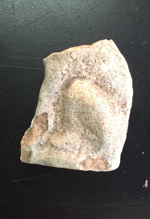
A tiny lion or feline figure has been found on the tel. Professor Jolanta Mlynarczyk of the University of Warsaw speaks about their significance to the dig.
For almost a year, I have been struggling. Whenever I was asked the dreaded “What do you want to do with your degree?” question, I always hesitated to respond, as frankly I am not sure what I want to do.
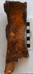
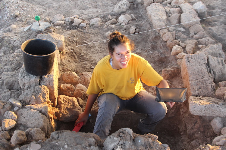
Some days ago University of Chicago student Gwen Christy excavated a fine example of a notched scapula, that is, a (in this case) cow’s shoulder blade incised with many notches running along one side of it. What was its purpose? These are known objects in archaeological sites in the Levant and Cyprus (mainly) but no one agrees on what their use(s) was/were. The truism in archaeology is that when we don’t know what something is, it must be cultic – and in this case too scholars have assigned the objects a religious function, perhaps divining future events in vague parallel with the use of differently modified scapulas from ancient China, a ritual known as ‘scapulomancy’. Others have suggested more mundane uses: the bridge of a stringed musical instrument (could it withstand the strings’ tension?), separating strands of yarn during weaving (would the notches have been deep enough to hold in the threads?), or making rasping sounds while a stick or bone was rubbed against it, perhaps during a ritual (but the area of the notches shows no where from such repeated actions). Other ideas have come to my mind — maybe the notches were used in accounting or for marking calendrical time. Yet, the notches are quite uniform, which suggests they were all made at once. So, although we now have one of the best-preserved examples of this object, the enigma continues.

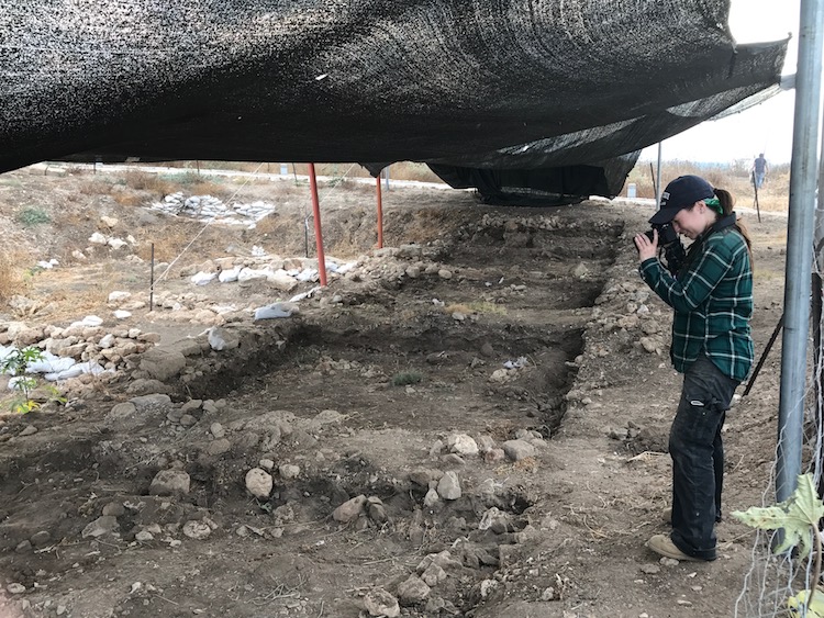
When you think of an archaeologist, what do you think of? A brawny man with a whip? A scrawny professor type? Basically people who are obsessed with the past and are very removed from reality? Not quite. Here at Tel Akko, we are leaping into the future with some cool tech that will not only benefit our search to understand the past, but will also lead to other applications in fields completely unrelated to archaeology. For the past few weeks I’ve been working on 3D photogrammetry. Every morning, before sunrise, a few of us go out to the tell to take pictures. Each day, we will be assigned a square which we then take pictures of from all angles.
We then take the pictures and put them into a program called AgiSoft. In this program, we take all of the photos and cover up all of the elements that we don’t want in the model, like shades, poles, or rope lines. The program then takes all of the photos and aligns the common features that it can then make a three dimensional model of.
Honestly, the computer does most of the hard work, but there is a little human effort that goes into making 50-some photos become a 3D representation of one of our squares. Most of my personal struggle comes from orienting the model. You would not believe how often I orient a model completely upside down and think it is right side up!
While the struggle can be somewhat frustrating, learning this program has been a lot of fun and given me a lot of opportunities that normally would not have happened. Seeing the sun rise up over the Mediterranean is one of the most beautiful sights I have ever seen. I may have to wake up a littler earlier and my day might be a little longer, but the mornings are peaceful and the results of all of our efforts are amazing. Like many things, it takes a village, and making these 3D models is no exception. It takes a lot of effort from our tiny team, and I really am trying.